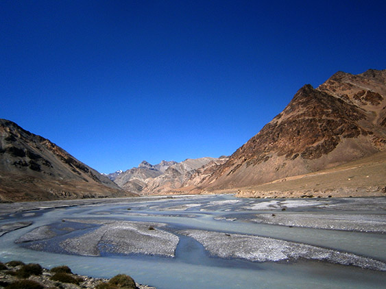
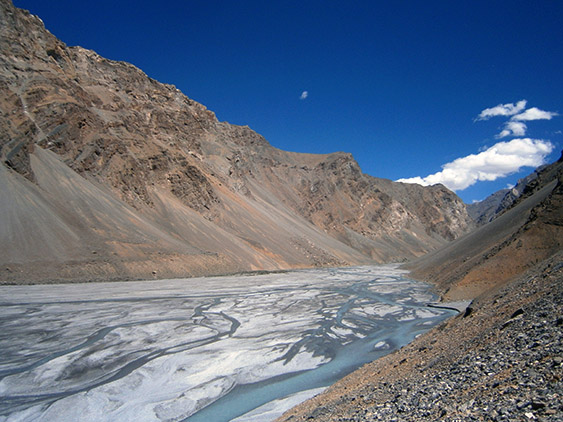
Parang River
26.08
Last day of rest before the final seven days of the trek. We spend the whole day at the beach, enjoying the sand, reading books, bathing in the nearby lagoon where the water is warmer. I know bathing is supposed to be something mundane, but we couldn’t take a normal bath in the last ten days. The only thing we could do was to wash one selves rapidly here and there. It is known that Tibetans don’t bathe for months, but now I totally understand them. It is just impossible – even in August, which is the warmest month here, it is still tricky to do it.
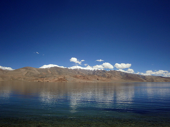
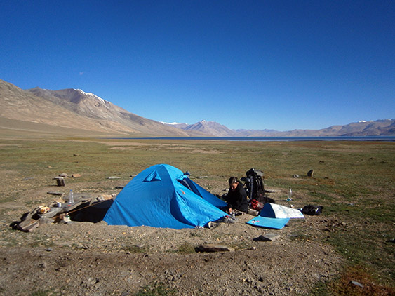
The lake with the highest peaks in the region
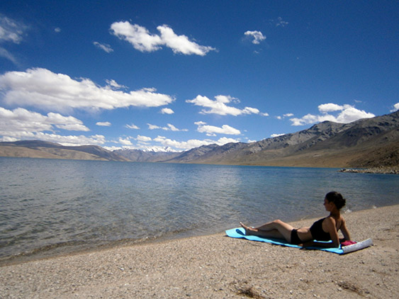
On the beach at 4500 m. altitude (14 800 feet)
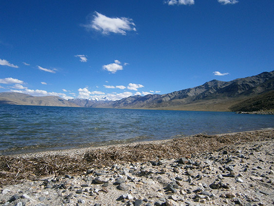
Tso Moriri
Let me tell you why: at noon when the sun is strongest I washed my hair and I almost regretted it. There was a weak wind and though the sun was shining, the temperature of the air actually was low and my head froze in seconds. I had to put a shawl over my head and get in the tent. At the same time our faces got burned and are now tomato red. So having this in mind it is no mystery why locals don’t like to take baths.

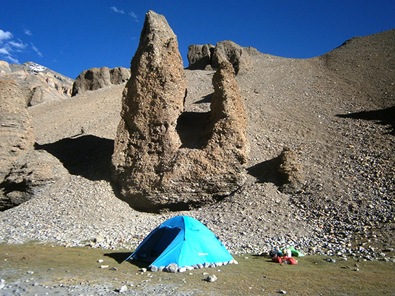
Nomad furniture
In the late afternoon we gather our bivouac and walk three hours to the end of the lake. We reach a wide plateau and after the sunset a terrible wind starts blowing. Luckily we find a nomad stone shelter that is sunken half a meter below the ground, but even there we barely manage to pitch the tent because of the strong wind. There is a stone fireplace inside and we somehow light fire and boil water for the instant noodles. I really don’t know how people survive here.
Our shelter against the strong wind
27.08
Today we walk on a desert-like rocky ground. Most of the time there is no path and we walk in the bare lands without a hint of shadow. In front of us we see the foot of the mountain that encloses the plateau of the lake. Yesterday while we walked next to the lake’s shore it looked no further than an hour walking. It is impossible to gauge the distance here by the eye. Everything looks pretty close and then you have to walk for hours to reach it.
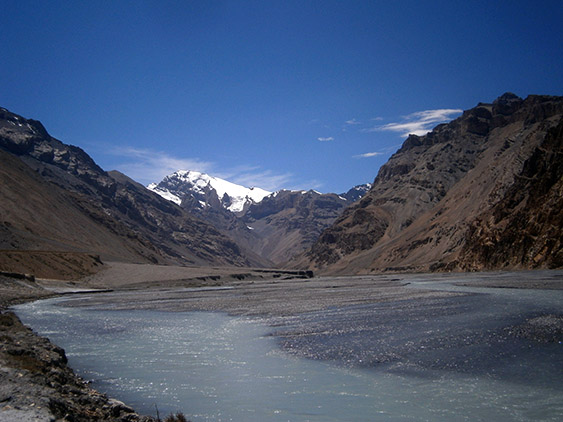
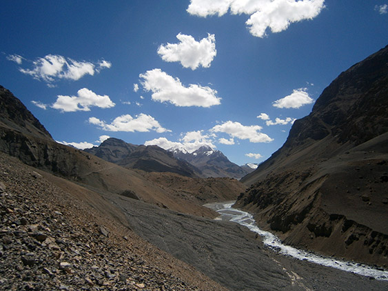
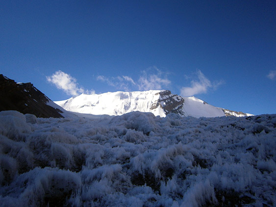
Parang River
Four hours later we reach the place where we intend to stay for the night. In front of us is Parang Chu River that is best to be crossed by noon because in the afternoon its level rises significantly. Down the river are located the winter camps of the Changpa nomads and further east the river enters Tibet. For the next three days we will be walking upstream, till we reach the pass where the state Himachal Pradesh begins. Then we start going down and the trek is over. At night the weather is calm and we spend a warm night.
28.08
We get up in the morning and see a group of Germans that come from the opposite direction. We start chatting with them and leave late. In front of us is a big challenge – the crossing of Parang River. We try to estimate where to cross it. We saw where the Germans did and this would help us. The water is at its lowest level this month and it reaches above ones’ knees. It also splits in many canals.
Parang River – do you dare to cross it?
Everything here is in pebbles as an alluvium and the water creates deep canals where one can’t even see the bottom. The banks of the canals are steep. If you make a wrong step you may fall down, luckily they are just 3-4 meters wide. The worst thing is that the water is freezing and your legs get numb in seconds. If the river is full it will be impossible to cross it – maybe its level rises to the level of the chest. We can also see that in other seasons the water flows on the deserted we walked on yesterday – in fact it seems that all the region turns into hundreds of flowing streams. For this reason one must do this trek from mid-August to mid-September. We crossed more easily and rapidly than we thought and after our feet unfroze we continued. We walked upstream for 5-6 hours more.
It’s hard to walk on the pebble alluvium
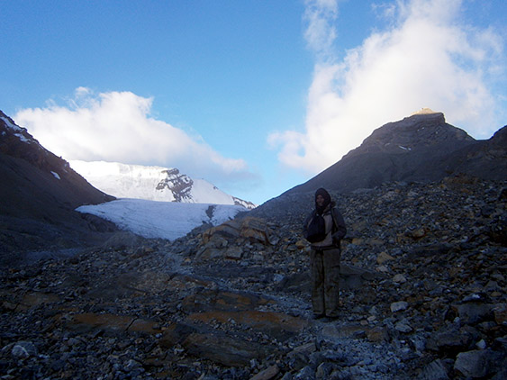
Parang River is really impressive. It has many canals formed in the form of pebbles alluvium and its color is surreal. Imagine the bluest sky you have ever seen and then add thousand tons of milk in it and you will get the unreal color it has. The banks on both sides are sandy and brown and above them mighty snowy peaks rise. Again we walk in a dream-like scenery.
We don’t have a map for the last leg of the journey, but close to us walks a group of two teenagers with horses, local guides and cooks. In the afternoon we find a small glade next to the river with strange sand formations above it and we pitch our tent.
Strange rock formations
29-30.08
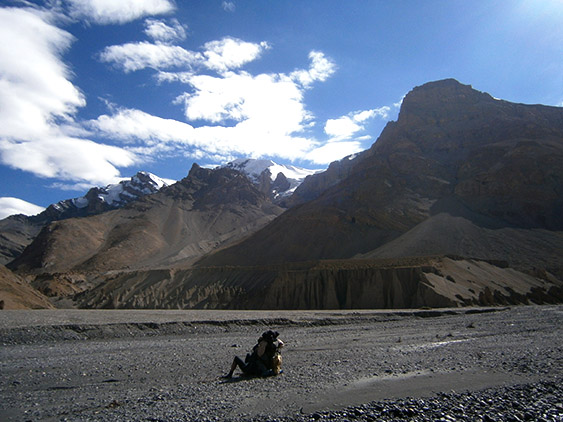
The next couple of days we walk in the Valley of Parang River. The scenery gets even more surreal and one asks oneself whether this is a dream or a reality. The higher we climb the stranger it becomes, even moss disappears and soon the green color becomes nothing but a memory for us. We walk around 6 hours a day and though the climbs are not steep, walking tires us because the path has pebbles and rocks on it – some are from the river, others from the mountain. We wear sneakers and sandals and this makes it even harder.
Up the river
Nights are cold so we put all our clothes on when we go to sleep. When the sun sets, the ice age arrives and waking up in the morning before the sunrise is painful. This morning a bunch of crows comes next to us and makes quite a performance – they chase each other, caw, croak and fly close above our heads.
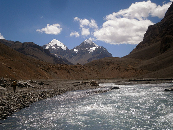
Twin Peaks

Parang La Pass in the distnce
On the 30-th in the afternoon we reach the base camp. The place is fearsome and somehow it doesn’t seem people friendly. The last pass is above us now. Huge ice tongue drops from its peak. It is covered in snow. This is the highest pass we have crossed – 5600 m. (18 370 feet).

Parang La
The two teenagers are at the camp. They struggle here every day. They barely graduated from school and decided to come in the Himalayas with no prior mountain experience whatsoever. I don’t know which tourist agency recommended them this trek (Indian humor?!).
Ice and snow piles
We watch them stumble exhausted every day and we feel pity for them. I don’t know how they manage to reach their campsites. After they do they usually crash at their tent and drink pills for headache, stomach discomfort and the likes.
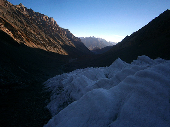
The glacier
Yesterday two Dutch guys descended from the pass – they were quite different from all the typical tourists here – no local guide, no horses and they went to sleep under the sky without even a tent with temperatures below zero (below 32 Fahrenheit). Well they have some super sleeping bags but…

The brave Dutch travellers
They told us we will cross without problems even wearing sneakers 🙂 It is 7:30 p.m. and we are in our beds already thinking about the climbing tomorrow.
31.08
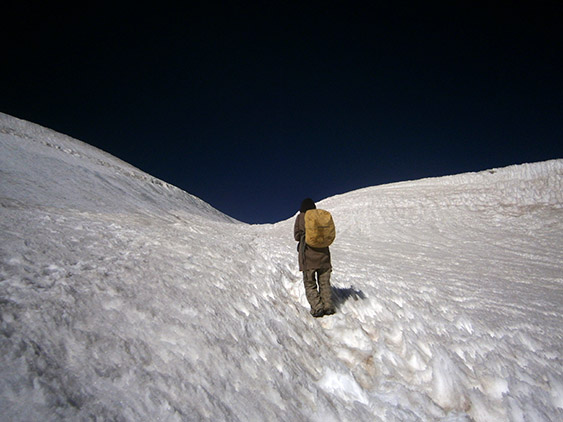
We get up at 4:30 a.m. because we need to leave no later than 6. The sun will cast its rays on the ice around 7:30 and this will make climbing extremely difficult because it will become slippery. So we have very limited time to climb the steep ice tongue. In fact we climb next to the ice on some bare ground with no ice on it. The problem is that it’s muddy and when ice melts it forms streams and one sinks in the ground. So our chance is to go through this is to cross while it’s still frozen.
Early in the morning
It’s 6 a.m. and the streams are frozen as our toes and fingers are. I think it is minus 7 Celsius (19.5 Fahrenheit). We manage to climb the peak before sunrise. Then we start walking on the plateau covered in hard ice that is easy to walk on. The last 1-2 kilometers are pretty steep.

Up we go
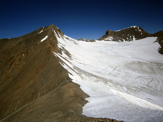
Little by little the snow starts to melt and my old sneakers start leaking. Mr. Shushtari has his rubber boots on and is dry. We climb for three hours and reach the colorful flags of Parang La Pass. There was a brief moment when we weren’t sure where exactly the pass is, but we saw the flags and oriented by them.
Crossing on the other side is emblematic for us because we leave Ladakh after two months of trekking around its glorious mountains. This is the end of our Himalayan experience. We will descend the mountain now and in around a week we will reach the plains and surprises of a different India. We will start a brand new type of adventures.
The end is near

On the other side of the pass
Descending Parang La turns out to be inhumanly difficult. There is no snow because this is the southern slope and there is no water too. Anywhere you look you see the endless Himalayas. The slope is very steep and every ten meters or so we slide and hit our ankles in the rocks. Two hours later we reach the bottom of the valley where we see a small stream. From here on we continue down a canyon and then walk an hour more in a narrow defile with high vertical walls. Good we had a two hour rest before we did this.
View from the nearby peak
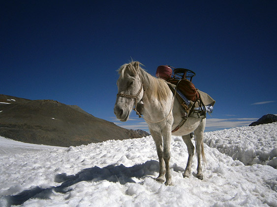
A horse

Noon reanimation
So the narrow path walks inside the canyon and then suddenly makes a sharp turn and enters a crevice in the cliffs. Then a small serpentine, with hundreds of turns, leads us at the top of a steep cliff. This is like this because the canyon down becomes unreachable and there is no place for the path. On the top there is a flat plateau with glades and springs and we stop here. Vegetation feels like something utterly new to us and we feel like we are at the gardens of Babylon, never mind that vegetation here is manly low, thorny bushes and some grass. We even manage to set fire with the twigs we find here and make chapatas (flat bread). Luckily there are cow excrements too (for the fire).

The canyon we came from
01.09
This is our last day of our Henry-David-Thoreau-like live into the wilderness and we are totally not in a hurry to reach Kibber Village. We leave in the afternoon. There are horses and a big group of people coming after us. Far behind them there is a horseman with a mule that doesn’t want to walk anymore and the horseman has to push it up the hill. Suddenly the mule drops and there is blood coming from its mouth. The man unloads it and we see that the animal has many wounds from the belts that hold the luggage, and obviously they were so tight it couldn’t breathe. The horseman says that it couldn’t bear the inhuman conditions – the cold and the altitude and got ill.
After some time it gets up and starts grazing. Few things make me mad and one of them is to see animals suffering. They put tons of useless baggage on the animals’ backs and make them walk in these harsh conditions where there is no grass to graze for days. On top of this they don’t let them rest well and don’t treat their wounds.
I just want to strangle the horseman and I don’t understand why they are ready to sell their souls for money. But tourists are much worse. They just care about themselves and nothing else. Do you know what the mule was carrying? The chaise-lounge of the brainless tourists! What kind of a person climbs at 5000 m. (16 400 feet) and carries a chaise-lounge?! It’s not enough that they don’t carry their rucksacks, but they take with themselves mango juice and caramel custard – both things that Tibetans haven’t even seen in their lives.
You can’t imagine what these animals carry on their backs: tomatoes, natural juices, eggs and many other things. One tourist is usually attended by six horses, a local guide, a horseman, a cook and sometimes second cook. The “personnel” pitches their tents, then fold them back and when tourists arrive at the camp they serve them immediately juice and snacks. I haven’t said anything up to now because anyone can do stupid things, even bring the “comfort” of one’s apartment at the beautiful pastures of Tibet. But to do this on the expense of suffering animals is too much for mе – it’s shameful and obnoxious. I wonder why don’t tourists йуст take with them some food and one two horse to carry their things?
But obviously to them it is very important to eat fruit salad sitting on a chair in one of the most raw and harsh mountains of the world… I wonder why nobody does this in the Alps, let’s say, or other European mountains? I really hope that the mule recovers well and a good thing is that its owner said that he won’t put weight on its back till it recuperates. Luckily their trek ends tomorrow.
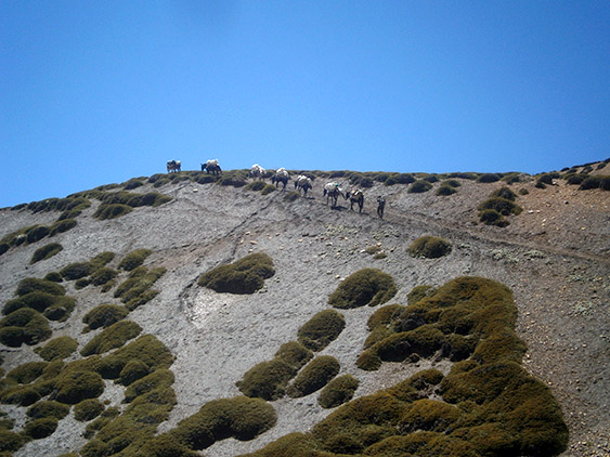
The horse caravan
We continued climbing ferociously. The camp, where this group of tourists plans to stay for the night, is a little bit up the hill, and since there is no one around, we have to help the horseman to carry the chaise-lounges up to the camp… This could only be the refined sense of humor of God… the only people here who are disgusted by this kind of tourism should carry the chaise-lounges 🙂 This is what I call real irony…

The canyon before Kibber Village
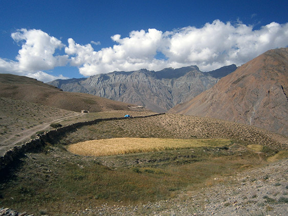
Descending down the village turns out to take long time because we are walking on millions of slippery pebbles. Our feet are tired of the 9-hour trek yesterday and we arrive at the village in the late afternoon exhausted. We are at Spiti Valley in the state Himachal Pradesh. Hills are covered with green grass and there are many agricultural fields. The architecture is similar to those at Ladakh, but it also has its own characteristics – there are giant black rectangular shapes drawn around their windows and most of the windows’ frames are bright blue. Spiti River flows next to the border with Tibet and the population is Tibetan. It will take us some more days to get down the plains, but from here on we continue hitchhiking.
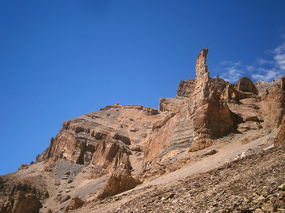
Beautiful cliffs
The new people, places and atmosphere are a shock to us. After 20 days into the wilderness where there were no roads, civilization and people we are disoriented by the cars and everything, though everyone says the region is remote and undeveloped.

First bivouac with vegetation
Everybody in the village gathers peas and sells it to the Indian merchants who came take it with trucks. There is no open shop so we pitch our tent after the village and boil the last instant noodles we have. We are at 4200 m. (13 800 feet), but it’s still cold at night so we sleep with our jackets on. I hope that in two-three days we will arrive at a warmer place. 🙂
Our bivouac near a field next to Kibber village – can you find the tent?
02.09
We hitchhike to Kye Monastery that is 7 km. before Kibber Village. The monastery is the biggest at Spiti Valley. A note for the regions we have been at that follow Vajrayana (Tibetan) Buddhism: in Kashmir these are Ladakh and Zanskar regions; similar to them are Himachal Pradesh and Lahaul, Spiti and Kinaur regions, we will visit the latter when we go south.

Kibber Village
The areas in Himachal also resemble each other, but all of the above regions have their own cultural specifics. People from Spiti Valley don’t leave much their region and we immediately notice the difference from Ladakhi people. The language here is closet to Tibetan. It also impresses us that people here appear happier, smile more and are more talkative.
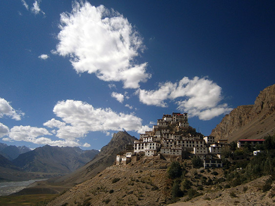
The Kye Monastery
The monastery is not so big, but the impressive part is that the main Lama is the 19-th reincarnation of Lotsawa a.k.a the Translator who is key figure to the Tibetan history. It’s been told that the Lotsawa, whose name was Rinchen Znagpo, was sent to Kashmir Valley together with twenty more monks to receive teachings because Buddhism was in decline here. On the other at that time (10-th century) Kashmir had been well developed center for Buddhism. Back then travelling took a long time and dangerous. Only two people survived the journey. One of them – Lotsawa, came back 17 years later in order to resurrect and spread Buddhism. Kye monastery and all the others in the region were established namely by him.
While we are walking around there is a crew filming a movie at the monastery. Its focus is on the Tibetans in exile. We start chatting with the main actress, a Tibetan who fled in India when she was a little girl. Up to this day she hadn’t seen her mother who still lived in Tibet. Strange thing here is that the director of the movie is a Chinese who lives in London. I think that after this movie they would never let him go back to China. At lunch they invited us to eat with the film crew who had prepared an improvised kitchen at the monastery and were cooking the food in big cauldrons. This is our first vegetable meal for the last 20 days so we eat triple portions of potatoes with milk sauce and broccoli with chick-peas in orange juice. I am sure that the people from the crew had never seen tourists who eat like this.
In the middle of all the hassle stands the most distinguished and worth of attention person – but nobody seems to notice him. He is an old man who sits in a room turning his praying wheel and mumbling mantras. He does this for hours now and has gloves on his hands to protect them.
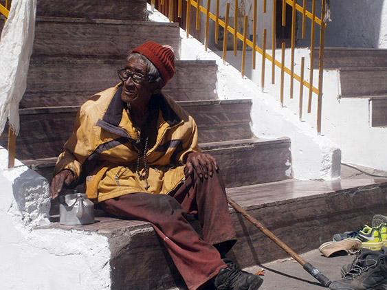
The most important person at Kye Monastery
The atmosphere is really authentic. In the kitchen one monk does figures from dough which they plan to use in some ceremony. On the roof of the monastery there is a big pink cake made of tsampa (baked barley flour) – the purpose of which remained unknown to us. The monks at the school sing sutras all the time.
After this really interesting visit we go to the village below the monastery. There are no cars and we wait a lot. At the end we start walking direction Kaza, the main city of Spiti Valley, which is 12 km. away from the village we are in. We walk for no more than 10 minutes and a pick-up stops by. We hop at the back where a freezer threatens to smash us at every turn. At the end we reach successfully Kaza.

Traditional house at Kibber Village
Our first job is to leave our rucksacks in a local shop and go around the town. We buy as much fruits as we can carry and receive a vitamin shock. Then we look for Internet and the owner of one hotel lets us use his laptop. It gets dark and we take our baggage and head outside of town. The owner of the hotel is perplexed by this and asks us where we are going. When we tell him he says we can pitch our tent in his backyard. He is really nice guy – a Punjabi.
03.09
Today we have to issue permits for crossing Spiti Valley that are needed because of the proximity with the Tibetan (Chinese) border. We are traveling on the road so we can’t avoid issuing one. The office where this is done is close to the hotel and the procedure turns out to be fast and easy – and free on top of this – something we didn’t expect.
All the afternoon we spend chatting with Karan, the owner of the hotel, who turns out to be a real adventurer and a high class hitchhiker so we interchange professional experience 🙂
We walk out of Kaza and a boy stops and takes us for the next 15-20 km. We get off his car and immediately a jeep with locals drives us to Tabo which is our next destination. Inside the car they listen loudly to Tibetan music and the men wear cowboy hats. The woman sitting next to us has a giant picture of Buddha Vairocana in her lap. The road turns into a dirt road and we travel the last forty kilometers to Tabo what seems an eternity. When we arrive it is already dark. The people leave us next to the monastery we’ve come to see. We find a nice place next to it and pitch our tent.
04.09
In the morning there are many people passing by us including some of the high priests, but nobody obviously minds us staying here. We decide to stay one more day in order to upgrade or hygiene. The altitude here is 3200 m. (10 500 feet) and the air is warm. The water in the river also has an acceptable temperature. We ask for a bucket form the locals and start washing our clothes. We also put several buckets of water on us since this is the first time we can bathe normally instead of just washing ourselves here and there. The end of our Tibetan life is near.
Tabo Monastery
In the afternoon we visit the monastery and it turns out to be something unique. This is the oldest monastery in India that is fully functional since its establishment and up to this day, without interruption. Its architecture differs a lot with all the other monasteries we have visited. It’s built on a flat ground, not on steep slopes as the others. Consists of five temples that are trapezoidal and have no paint or any decoration on them. They are all made of clay.
The writings on the walls inside them are 1000 years old and are well preserved – the paint still has its colors, but unfortunately there is water sipping at some places in the walls. The typical mandalas and the wheel of life are lacking and instead we see paintings of giant Bodhisattvas and Buddhas. All is very different. It seems that now the monastery is more a museum though. Next to it there is a new big monastery where monks live and study.

The old and the new monastery
After this visit we climb some rocks next to the monastery where the meditation caves are located. Nowadays they are more of a landmark and nobody uses them. When we go back at the tent in the evening we discover that a cow had eaten our tomatoes and a dog carried away the bottle with the cooking oil 🙂

Temples at the old monastery
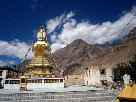
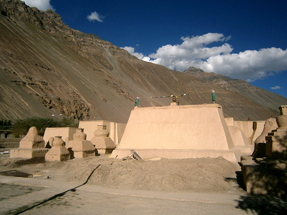
The stupa of the monastery
05.09
In the afternoon we start hitchhiking down. There are no cars, but after forty minutes a Dutch girl and an Israeli stop and take us. They tell us they have read about an old mummy in some remote village in the region. Strange thing is that nobody here had heard of the mummy, nor the people the village, not even the driver who shows around tourists in the region for the last 15 years.
It’s in our direction and we will divert only 8 km. so we decide to go and see the mummy. The village called Gue is not even on the map. The mountain in front of the village belongs to China, Tibet. This is the first time we see a mummified body.
The person was a monk who lived 500 years ago and the legend says he suddenly stopped eating and drinking water. After his death his body mummified. This saved the village from the scorpions that flooded them before this – at least this says the sign here. The body wasn’t embalmed and was discovered recently. They don’t know how it remained so well preserved. I’ve read that monks back then drank small quantities of some poison that preserved their bodies after their death.
The dry climate also helped for the preservation. Nowadays the mummy is kept behind glass, but is exposed to direct sunlight and open air and in my opinion won’t last long. We even saw some mould on one of its knees. It is incredible that the mummy is so well preserved that we could even see its nails and small body hairs. We took a good look at it and it’s totally real. Even Hinduists worshipped the monk flabbergasted by this miracle.
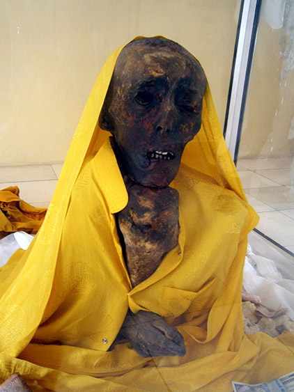
The mummy
After this wonderful diversion we get back on the road and continue to Kinuar region. We see Tibet only a few kilometers from us. No wonder why there are military stations everywhere here. Half an hour later we reach Nako Village. It is getting dark and we look for a place to stay. Nako is an old village with traditional architecture and a small lake next to it. We’ve forgotten to eat today so we settle next to the lake and start cooking.

Bivouac at Nako village
